
This is the second post in a four part series on LEO satellites by Ulrich Speidel.
Other posts: Part one, part three, part four.
In this blog series, we look at what is known about Low Earth Orbit (LEO) networks, what that tells us about the potential of these networks, and whether they’ll be the right choice in a particular situation.
There’s only so much that LEO providers such as Starlink, OneWeb, Project Kuiper and others have been willing to share with the public so far. In several cases, this information has only come to light in regulatory filings.
Three questions to consider
In this part of the series, I’ll be examining questions that we ought to ask of LEO providers, and I’ll explain why the answers are important:
- What’s your constellation?
- How many gateways do you have that are connected to the wired Internet, and where are they?
- Does your end-user terminal need a steerable antenna to track a satellite?
Let’s dive right in!
What’s your constellation?
To be fair to LEO providers, this is generally public knowledge because the rest of the space community needs to know where exactly the new LEO satellites will be zipping around, so we don’t get collisions in space that’ll leave earth surrounded by a rubbish belt that’ll be lethal to any new launches. So the regulators make sure that this is on the public record.
For us as potential users of LEO systems, the answer to that question is important for two altogether different reasons. Firstly, it tells us the inclination of the orbital planes, which in turn, tells us how far north and south the network’s coverage will go. At present, Starlink only has 10 satellites heading for orbits with inclinations in excess of 60 degrees, meaning that Antarctica, big chunks of Scandinavia, much of Alaska and swathes of Russia aren’t currently covered. OneWeb, on the other hand, has so far talked about polar orbits only — these reach all latitudes.
Also, the number of orbital planes is of interest. This tells us how far apart satellite orbits are at the equator. For example, in 2019, Starlink asked to use 72 planes. The equator is roughly 40,000 long at ground level, or 43,845 kms at the orbital height of 550 kms that the Starlink satellites fly at. Each orbit intersects the equatorial plane twice (once in the northbound and once in the southbound direction), which gives an average of 43,845 / (2 * 72) ≈ 300 kms between orbits at the equator.
The number of satellites in each plane tells us the distance between satellites in the same orbit. With the 72 planes, that was meant to be 22 per plane — almost 2,000 kms between satellites. This in turn gives us a good idea of the sort of hop lengths the network will incur when inter-satellite routing starts. But, alas, as of February 2021, Starlink purportedly uses 28 planes only, giving around 775 kms between orbits at the equator. This should give around 56 satellites per orbit at the start of commercial operation, which equates to an average distance between satellites on the same orbit of also 775 kms (far more symmetrical). By the time you read this, it may have changed again.
Incidentally, LEO constellations have naturally higher satellite concentrations per area at the higher latitudes of their orbits, as there’s just not as many miles of latitude to cover compared to the equator. So you can expect more satellites in view on the northern and southern fringes of the coverage area. For somewhat incomplete constellations like the current ones, this means fewer and shorter ‘no satellite’ periods for end users there. It’s probably why Starlink is currently limiting beta testing to users between about 30 and 50 degrees of latitude. The current live coverage map shows that the largest areas with gaps in continuous coverage are indeed in the tropics, as one would expect. In other words — your favourite tropical island may have to wait a little longer for proper Starlink coverage. OneWeb, on the other hand, plans to use around 600 satellites in 12 orbital planes at 1,200 kms altitude. The higher altitude makes it somewhat easier to provide continuous coverage. If you’re near the poles, every single one of OneWeb’s satellites will fly overhead once every 100 minutes or so and will be in easy sight for several minutes, meaning you get the pick of the crop.
How many gateways do you have that are connected to the wired Internet, and where are they?
One can glean part-answers to this question from official documents, too, at least for some regions. For example, Starlink have licences for around half a dozen gateway sites in New Zealand, with locations in the public domain. But a licence doesn’t guarantee that a gateway is currently operational.
What is clear, though, is that a Starlink LEO flying at 550 kms above ground has a ground footprint of only about 4,700 kms diameter, which is the largest distance the satellite can theoretically bridge between ground stations without inter-satellite routing (which neither Starlink nor OneWeb do at this point) when the satellite is just visible on the horizon. Photos of fencing around one of Starlink’s known New Zealand sites suggests the antennas there require satellites to be well above the horizon to receive service. Starlink also has pretty strict requirements in terms of a clear view of the sky at the user site. The picture around the world is less clear. Say they need the satellite to be at least 30 degrees above the horizon at either end. In that case, the ground footprint diameter comes down to about 1,570 kms. That’s a lot less than the distance between Auckland and Sydney.
Even this ‘bent pipe’ is only possible if the satellite so happens to be right above the great circle line between the two ground stations. A bit off the side or a bit closer to the one ground station than the other, and that 1,570 kms range decreases quickly. Realistically, this means that places must be within a few hundred kilometres of an Internet-connected gateway to have a reasonable chance of more-or-less continuous Starlink service now. It also explains spacing between orbital planes and between same-orbit satellites.
Due to their higher orbital altitude, OneWeb, should be able to get away with fewer gateways here, but they are also planning for fewer satellites.
But gateways are also important for another reason. Not every Internet-connected piece of ground is necessarily suitable, for regulatory and political reasons. So if you’re on an island and your nearest piece of fibre-connected land belongs to people your LEO provider doesn’t trust, then you might not get service.
Once inter-satellite routing is working, one can, in principle, get away with far fewer gateways and obtain service further away from gateways, but this potentially incurs extra latency if traffic needs to be routed back on the ground from a remote gateway to a region closer to the user. That said, this issue isn’t exactly unheard of on the fibre-based terrestrial Internet either.
Does your end-user terminal need a steerable antenna to track a satellite?
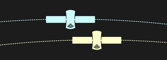
The current Starlink end-user terminals — dubbed ‘Dishy McFlatface’ or just ‘Dishy’ — most certainly has the ability to move mechanically, but it uses a phased array antenna for seamless handovers when another satellite takes over as the previous satellite moves out of sight. As long as at least two suitable satellites can be kept continuously in view of Dishy’s array with sufficient signal strength, it shouldn’t need to move mechanically. However, including two motors and a positioning gearbox could indicate that Starlink has engineered for situations where this may not be the case. So it will be interesting to learn what circumstances will cause Dishy to literally swing into action.
Dishy’s phased array antenna is a technology that was previously not really associated with end-user equipment but rather with astronomically expensive military hardware. It can communicate with multiple satellites in view using electronic beamforming. Each antenna element in a phased array radiates or receives a signal that’s time-shifted by a precisely predetermined amount, so that signals from/to the desired direction add up and those from/to other directions cancel out (ideally). Such an antenna can switch satellites in an instant and even track multiple satellites at once.
Dishy’s phased array uses a large number of elements, but the need for moving parts suggests the phased array’s performance is just enough in order to switch over to a nearby satellite, such that the angle between ‘old satellite’, Dishy and ‘new’ satellite isn’t all that great. Now, could this result in a period of suboptimal connectivity until the dish has physically moved to point at the new satellite, especially around tropical latitudes? Could that stop my movie?
O3b MEO ground stations usually track with two or more dishes so they can always maintain connectivity to at least one satellite. But do you offer such antenna diversity for your LEO solution, dear provider? If I live on a boat, how choppy can the water get before my dish loses track?
But I understand that a more complex phased array may just be beyond your end user device budget right now. Then again, who knows? Maybe someone can make Moore’s Law work on these and bring the price down for the next generation of ground stations? Maybe your network could even be using open standards (or make its standards open) so others can build and sell terminal equipment as well?
In the next episode of this blog, we’ll look at LEO bandwidth, system capacity, and inter-satellite routing.
This series continues with Part 3: Bandwidth, system capacity and inter-satellite routing.
Dr Ulrich Speidel is a senior lecturer in Computer Science at the University of Auckland with research interests in fundamental and applied problems in data communications, information theory, signal processing and information measurement. The APNIC Foundation supported his research through its ISIF Asia grants.
The views expressed by the authors of this blog are their own and do not necessarily reflect the views of APNIC. Please note a Code of Conduct applies to this blog.